
New Zealand · 12.09.2026
Two Thumbs
Level 1: 1800 m–and above · Level 1: 1200 m–1800 m

Low
Danger level
1 — Low
Snowpack stability
The snowpack is well bonded and stable in general.
Likelihood of triggering
Triggering is generally possible only from high additional loads in isolated areas of very steep, extreme terrain. Only small and medium natural avalanches are possible.
Avalanche problems

Wet snow
The avalanche problem is related to a weakening of the snowpack due to the presence of liquid water. Water infiltrates the snowpack due to melt or rain.
Good timing and trip planning are important. Consider avalanche runout zones.
Affected aspects
WestNorthwestNorthNortheastEast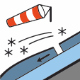
Wind slab
Wind slabs are formed when loose snow in near-surface layers (new snow or old snow) is transported and deposited by wind.
Avoid wind-drifted deposits in steep terrain.
Affected aspects
NorthwestNorthNortheastEastSoutheast
Stability
Surface Snow Conditions: Around 10cm of new snow fell on Thursday morning. This has been distributed by gale south westerly winds on Friday. Exposed areas are stripped back to previous crusts and sheltered areas are wind loaded. Snowpack Structure: Previous Base: any remaining snow sits on hard/textured crusts over a moist base or bare ground. Several melt-freeze and ice layers with currently none-reactive weaker snow in between them still exist above 1800m. Total Depth: Generally 40–75 cm, reaching 100–120 cm in sheltered spots. Pictures from Camp Stream area from Thursday (9 Sep).
Snow quality
A few small (size 1) avalanches were observed at approx 2000m on a SE aspect. They appeared to be windslabs, it is unsure when they ran, but probably around the 10th. If you see any activity on the Two Thumb Range, please make a public observation. It helps us to produce accurate forecasts.
Weather
Mainly fine with morning frosts and some evening cloud.Wind at 1000 metresWesterly gale 75 km/h, easing to southwesterly 30 km/h in the morning, then dying out in the afternoon.Wind at 2000 metresSouthwesterly severe gale 90 km/h, easing to 40 km/h in the morning.Freezing level1700 metres, lifting to 2000 metres in the afternoon.