
New Zealand · 12.09.2026
Wanaka
Level 2: 1800 m–and above · Level 2: 1200 m–1800 m · Level 1: 1200 m–and above

Moderate
Danger level
2 — Moderate
Snowpack stability
The snowpack is only moderately well bonded on some steep slopes; otherwise well bonded in general.
Likelihood of triggering
Triggering is possible, primarily from high additional loads, particularly on the indicated steep slopes. Very large natural avalanches are unlikely.
Avalanche problems
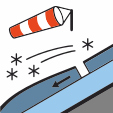
Wind slab
Wind slabs are formed when loose snow in near-surface layers (new snow or old snow) is transported and deposited by wind.
Avoid wind-drifted deposits in steep terrain.
Affected aspects
NorthNortheastEastSoutheastSouth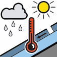
Wet snow
The avalanche problem is related to a weakening of the snowpack due to the presence of liquid water. Water infiltrates the snowpack due to melt or rain.
Good timing and trip planning are important. Consider avalanche runout zones.
Affected aspects
WestNorthwestNorthNortheast
Stability
Snow overnight Wednesday (10/15cm) has been redistributed by strong West/South West winds over the past 48 hours. In areas sheltered from the wind, you can find cold dry snow and quality turns. Snow on 6/9 from the South East with limited wind. Expect the snow pack to be holding a significant amount of moisture below about 1900m. Melt/freeze conditions on solar (North facing) slopes.
Snow quality
On Thursday 10/9 a boarder triggered a size 1.5 Wind Slab in the back country south of Treble Cone (Aspect East, Elevation 1720m). Control work at Treble Cone on 10/9 produced numerous Wind Slab results (size 1 and 1.5) on East facing slopes. A widespread cycle of natural avalanches (Wet Slab and Loose Wet below 1800m and Wind Slab at higher elevations) occurred during the last storm 26th - 28th August. If you see evidence of avalanches in the back country please enter a Public Observation.
Weather
Saturday - mostly fine with perhaps a few showers. Snow down to 1300m at night. Strong West/South West winds - gale to severe gale at upper elevations. Freezing level - 1000m rising to 1500m in the afternoon.