
Switzerland · 18.05.2026
Bex - Villars
Valid until 18.05.2026 15:00
Get daily danger levels for your starred regions by email. Subscribe here

Moderate
Danger level
2 — Moderate
Snowpack stability
The snowpack is only moderately well bonded on some steep slopes; otherwise well bonded in general.
Likelihood of triggering
Triggering is possible, primarily from high additional loads, particularly on the indicated steep slopes. Very large natural avalanches are unlikely.
Avalanche problems

No distinct avalanche problem
This is not a specific avalanche problem. It is a very inconclusive scenario, without a clear pattern that a user could follow to lower consequences. Any avalanche type is possible. Do not consider the absence of a typical avalanche problem as safe conditions. Normal caution is still advised.
Do not interpret the absence of a typical problem as safe conditions.
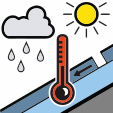
Wet snow
The avalanche problem is related to a weakening of the snowpack due to the presence of liquid water. Water infiltrates the snowpack due to melt or rain.
Good timing and trip planning are important. Consider avalanche runout zones.
Hand Job Gloves
A work glove for the mountain professionals. No bells, no whistles — just goat leather, a simple cut, and gear that stays on. Pure function. Built to take the beating.
Visit Hand Job Gloves →
Stability
SnowpackThe new snow and wind-drifted snow from recent days are still partly prone to triggering, especially on shaded slopes in high alpine terrain. At the transition to the underlying old snowpack, coarse-grained weak layers are still present in some places, particularly on north- and east-facing slopes at higher elevations.
Snow quality
SnowpackThe new snow and wind-drifted snow from recent days are still partly prone to triggering, especially on shaded slopes in high alpine terrain. At the transition to the underlying old snowpack, coarse-grained weak layers are still present in some places, particularly on north- and east-facing slopes at higher elevations.
Tendency
Outlook to WednesdayMonday night into Tuesday will be partly cloudy in the east and a little snow will fall above 1800 m. In the morning, there will still be residual clouds in the east. Elsewhere, it will be quite sunny at first before clouds move in from the west. In the afternoon, there will be showers in the west, falling as snow above 2200 m. Tuesday night into Wednesday will be clear in the south and often cloudy elsewhere. In central and eastern Switzerland, up to 10 cm of snow will fall above approximately 2200 m. During the day, it will be cloudy with showers in the east. In the west, conditions will be changeable, and in the south it will be quite sunny. There will be a westerly wind on both days, mostly light on Tuesday and moderate at times on Wednesday. The zero-degree level will be at 2500 m on Tuesday, rising towards 2800 m on Wednesday afternoon.The danger of dry avalanches will decrease. Dry avalanches can still be triggered, primarily on very steep north- and east-facing slopes in the high alpine regions. The danger of wet avalanches will increase slightly as each day progresses. Backcountry ski tours should be completed early.