
Switzerland · 18.05.2026
oberes Puschlav

Moderate
Danger level
2 — Moderate
Snowpack stability
The snowpack is only moderately well bonded on some steep slopes; otherwise well bonded in general.
Likelihood of triggering
Triggering is possible, primarily from high additional loads, particularly on the indicated steep slopes. Very large natural avalanches are unlikely.
Avalanche problems
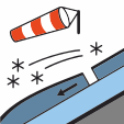
Wind slab
Wind slabs are formed when loose snow in near-surface layers (new snow or old snow) is transported and deposited by wind.
Avoid wind-drifted deposits in steep terrain.
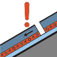
Persistent weak layers
The avalanche problem is related to the presence of one or more persistent weak layers in the old snowpack. These weak layers typically include faceted crystals, depth hoar or surface hoar crystals.
Travel conservatively. Remote triggering and crack propagation over long distances is possible.
Stability
SnowpackThe new snow and wind-drifted snow from recent days are still partly prone to triggering, especially on shaded slopes in high alpine terrain. At the transition to the underlying old snowpack, coarse-grained weak layers are still present in some places, particularly on north- and east-facing slopes at higher elevations.
Snow quality
SnowpackThe new snow and wind-drifted snow from recent days are still partly prone to triggering, especially on shaded slopes in high alpine terrain. At the transition to the underlying old snowpack, coarse-grained weak layers are still present in some places, particularly on north- and east-facing slopes at higher elevations.
Tendency
Outlook to WednesdayMonday night into Tuesday will be partly cloudy in the east and a little snow will fall above 1800 m. In the morning, there will still be residual clouds in the east. Elsewhere, it will be quite sunny at first before clouds move in from the west. In the afternoon, there will be showers in the west, falling as snow above 2200 m. Tuesday night into Wednesday will be clear in the south and often cloudy elsewhere. In central and eastern Switzerland, up to 10 cm of snow will fall above approximately 2200 m. During the day, it will be cloudy with showers in the east. In the west, conditions will be changeable, and in the south it will be quite sunny. There will be a westerly wind on both days, mostly light on Tuesday and moderate at times on Wednesday. The zero-degree level will be at 2500 m on Tuesday, rising towards 2800 m on Wednesday afternoon.The danger of dry avalanches will decrease. Dry avalanches can still be triggered, primarily on very steep north- and east-facing slopes in the high alpine regions. The danger of wet avalanches will increase slightly as each day progresses. Backcountry ski tours should be completed early.