
Nouvelle-Zélande · 05.11.2026
Aspiring
Niveau 2: 2000 m–et plus · Niveau 2: 1500 m–2000 m · Niveau 1: 1500 m–et plus
Valable jusqu'au 07.11.2026 07:04
Recevez chaque jour par e-mail les niveaux de danger de vos régions étoilées. S’abonner ici

Limité
Indice de risque
2 — Limité
Stabilité du manteau neigeux
Le manteau neigeux n'est que modérément stabilisé dans quelques pentes raides, sinon en général bien stabilisé.
Probabilité de déclenchement des avalanches
Déclenchements d'avalanches possibles surtout par forte surcharge et dans quelques pentes raides, généralement décrites dans le bulletin. Des départs spontanés de très grandes avalanches ne sont pas à attendre.
Situations avalancheuses
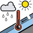
Neige humide
Cette situation est liée à la déstabilisation du manteau neigeux du fait de la présence d'eau liquide. Cette dernière provient de la fonte de la neige et/ou de la pluie.
Un bon timing et une planification sont importants. Tenez compte des zones d'arrivée des avalanches.
Orientations concernées
Nord-estEstSud-estSudSud-ouestOuestNord-ouestNord
Hand Job Gloves
A work glove for the mountain professionals. No bells, no whistles — just goat leather, a simple cut, and gear that stays on. Pure function. Built to take the beating.
Visit Hand Job Gloves →
Stabilité
1-4/11 111mm of rain up to around 2600m 28-29/10 10- 25 cm of new snow fell above around 1600m with gale west-southwest winds followed by a dusting down to around 800m. 25 -26th/10 130mm of rain has fallen on the divide. This will have saturated the snowpack up to around 2300m. Before this, most aspects and elevations are now showing spring snowpack characteristics, where conditions are generally firm and icy in the mornings, then turn isothermic, wet, and unsupportive during the warmer hours of the day. The snowline is retreating quickly and is currently about 1550 m on south aspects and 1800 m on east and west aspects.
Qualité de la neige
Mostly due to the poor weather, there have been no recent reports of avalanche activity in the region. If you see any recent avalanche occurrences or have any relevant snowpack information or photos, you can share them via the Public Observations link on the NZAA home page.
Météo
Mt Aspiring National Park Forecast Today5 NovRain, falling as snow above 2700 metres.Wind at 1000 metres Northwesterlies 45 km/h.Wind at 2000 metres Northwesterlies 45 km/h.Wind at 3000 metres Northwesterlies 45 km/h.Freezing level About 2900 metres.